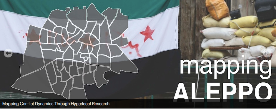
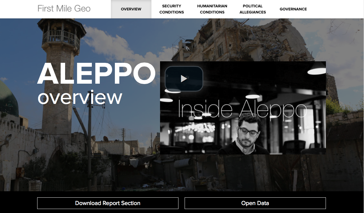
I’ve posted about mapping the war in Syria and its spillover effects before (see here and here), but most of these projects cover a wide area with varying degrees of reliability. Now News from Laleh Khalili of a report from David Kilcullen‘s Caerus Associates (with the American Security Project) on the civil war in Aleppo, “Mapping the conflict in Aleppo, Syria”, which provides a much more fine-grained view of what is happening on the ground. You can download the report here or view the interactive version via First Mile Geo here, and you can read an account of the project from Wired‘s Greg Miller here.
Caerus has also joined with the Pentagon’s Center for Complex Operations to produce a special supplement of PRISM (vol. 4, 2014) on the Syrian conflict, which includes an essay by Kilcullen and Nathaniel Rosenblatt on ‘The Rise of Syria’s Urban Poor: Why the War for Syria’s Future Will Be Fought Over the Country’s New Urban Villages’; the whole issue is available on open access here.
These interventions are important and interesting for several reasons.
First, the report is based on exacting local fieldwork. Acknowledging that local people in conflict zones develop vitally important stocks of local knowledge as a means of survival, the report also accepts that this ‘information-rich environment remains analytically poor.’ For that reason, the field teams ‘provided training and cloud-based tools to help local actors collect locally understood knowledge about their conflict for rigorous analysis.’
From September 16, 2013 to January 6, 2014, we collected four types of information: a monthly survey of perceptions among 560 residents in Aleppo’s 56 neighborhoods, biweekly location and status data for bakeries (a key indicator of humanitarian conditions due to the centrality of bread in the Syrian diet), biweekly location and status data on security checkpoints (a key indicator of security, territorial control and public safety conditions), and a monthly neighborhood-level assessment filled out by our enumerators. These four data streams not only allowed the research team to detect and visualize shifts in the environment in near-real time, but also provided an extremely rich source of insights on the geo-social dynamics at play. All field research was conducted in Arabic.
First Mile Geo notes that it will make the data available to organisations ‘for responsible use’: see Open Data here.
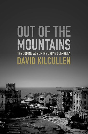 Second, Kilcullen’s analytical argument (he is described as ‘Principal Investigator’ for the Mapping project) is, naturally enough, fully conformable with the thesis he develops at length in his latest book, Out of the mountains: the coming age of the urban guerrilla (2013); the report reveals the grisly details of contemporary siege warfare and urbicide – central themes in the book, where Kilcullen notes the work of Steve Graham and Eyal Weizman – and gestures towards a future ‘feral city’ (how I hate that phrase) broken into multiple fiefdoms where gangs and militias exact violence and provide rudimentary services to the residents:
‘The inability of opposition groups to aid residents of neighborhoods they control suggests Aleppo – and Syria as a whole – will become a mosaic of small, intersecting fiefdoms, each providing assistance to its respective neighborhood without regard to macro-level concerns for national governance and reconciliation. Growing warlordism may be particularly acute in Aleppo, where economic rent-seeking opportunities will attract armed gangs who will attempt to seize control of its neighborhoods. These “conflict entrepreneurs” will have little incentive to end a conflict from which they derive power, prestige, and profit. Even in the event of peace, Aleppo’s strategic location will help these actors establish roots for illicit networks that may endure well beyond the present conflict. Moreover, as a non-capital city, Aleppo will not benefit from national government attention. Instead, Aleppo’s future may resemble that of similarly conflict-plagued second cities in the Middle East, such as Mosul in Iraq or Benghazi in Libya. These cities are plagued by warlordism and dominated by illicit economies. They have quickly become safe havens enabling terrorist networks to plan, recruit, and launch attacks.’
I’ve posted about Out of the Mountains here, when I promised an extended commentary: Laleh and I will be working on a joint examination of Kilcullen’s larger thesis in the near future, so watch this space. We already have Mike Davis‘s thumbnail view:
‘Although an enemy of the state, I must concede that this is a brilliant book by the most unfettered and analytically acute mind in the military intelligentsia. Kilcullen unflinchingly confronts the nightmare of endless warfare in the slums of the world.’
Here, incidentally, it’s revealing to read Kilcullen’s theses alongside Neil Brenner‘s ‘Theses on urbanisation’, Public culture 25:1 (2013) 85-114, which makes a series of suggestive proposals – but from which war is strikingly absent. So Kilcullen’s thesis certainly demands serious scrutiny, particularly by those who think that the future of war is somehow encapsulated in the drone. In my previous note, I joined Geoff Manaugh in being sceptical about the ‘aerial-algorithmic’ interventions that attracted Kilcullen in a series of talks based around the book, but ‘Mapping the conflict in Aleppo’ reveals a much more substantial interest in ‘the facts on the ground’, local actors and local knowledge. (And here a good counter-text would be the brilliant work of AbdouMaliq Simone; see also his blog, Villes-Noires, here). So, as I say, watch this space.
But there’s a third reason this matters. I’ve been reading and thinking about Jeremy Crampton, Sue Roberts and Ate Poorhuis‘s ‘The new political economy of geographical intelligence’ – a fine essay in the Annals of the Association of American Geographers 104: 1 (2014) 196-214 – and I’ll be returning to this in the next day or two. They emphasise the importance of satellite imagery in the production of US geospatial intelligence, whereas I’ve been developing a different (though related) argument about the importance of satellite communications for the ‘everywhere war’. In both cases, there is an intimate relation between ‘milsat’ and ‘comsat’, the military and commercial sectors, which will come as no surprise to those who’ve been plotting the extending contours of the military-industrial complex.
Those contours have snared all sorts of other institutions, of course, which is why James Der Derian talks about MIME-NET (the military-industrial-media-entertainment network) and I’ve talked about MAIM-NET (the military-academic-industrial-media network). The role of universities in the development of military capabilities and military knowledge (and ultimately the production of military violence) is no less surprising, of course, and in fact there’s a session on ‘Geography and the military’ organised by Eric Sheppard at the AAG conference in Tampa (an appropriate location for several reasons) to debate these issues. But it should now be clear that the production of these geographical knowledges is not confined to the military and civilian intelligence agencies, the academy and large corporations but also includes a host of much smaller private contractors devoted to ‘geographical intelligence’. They come in different shapes and sizes, and with different agendas. Caerus, for example, describes itself as a ‘strategy and design firm’ that helps clients ‘understand and thrive in complex, conflict-afflicted, and disaster-affected environments’. But there are many others, and it’s important not to lose sight of their role in what the US military would call ‘shaping the battlespace’…

Pingback: Mumford and sons | geographical imaginations
Pingback: War and therapeutic geographies | geographical imaginations