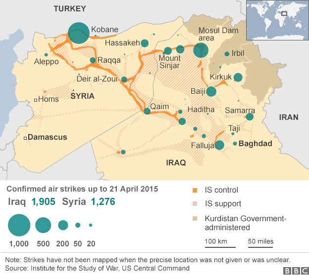
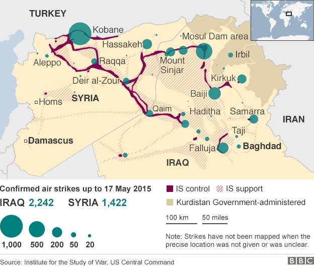
I’ve taken the maps above from the BBC, which rely on reports from the Institute for the Study of War and news releases from US Central Command on ‘Operation Inherent Resolve‘.
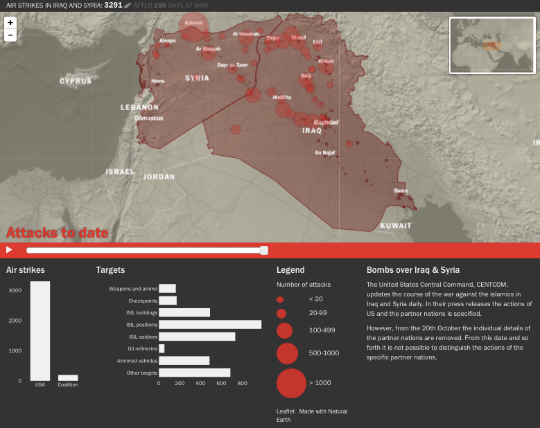
For readers wanting to follow and analyse the US-led air campaign in Iraq and Syria in more detail, I recommend Chris Woods‘ new project, Airwars. Chris is a veteran of the Bureau of Investigative Journalism’s Drone War Project and the author of Sudden Justice: America’s secret drone wars (2015) – which really is the gold standard for analysis of US remote operations.
Airwars.org is a collaborative, not-for-profit transparency project aimed both at tracking and archiving the international air war against Islamic State (Daesh), in both Iraq and Syria. We also seek to highlight – and follow up where possible – those cases in which claims of civilian non-combatant casualties from coalition airstrikes have been indicated by credible monitoring agencies. In addition we track reported ‘friendly fire’ incidents.
The site includes tabulations and also an interactive, zoomable map (see the screenshot below). You can find a detailed discussion of sources and methodology here.
I’m tracking all this for The everywhere war… In case you are wondering why that is taking so long to finish: The colonial present started out as an essay on 9/11 and the US invasion of Afghanistan; I then realised that Sharon was taking advantage of the ‘war on terror’ to ramp up Israeli dispossession and repression of the Palestinian people, and so started work on a second essay (I’m ashamed to say that at the time I knew as little about the West Bank and Gaza as I did about Afghanistan on 11 September 2001). Then the US invaded Iraq… Much the same is happening with The everywhere war, but I do have the end in my sights. I hope.
