

As a supplement to my previous post on mapping the bombing of Germany in the Second World War, I thought I should draw attention to Lauren Turner‘s report on the maps RAF Bomber Command had drawn to show the effects of its raids on individual cities. I described the construction of target maps in ‘Doors into nowhere’ (DOWNLOADS tab); these maps were compiled for the Blue Books kept by Arthur Harris as chief of Bomber Command (above). In the summer of 1943 Harris ordered the preparation of a large book (which eventually extended to several volumes) which would show the “spectacular” results of the bomber offensive. “After each attack on a German city,” he explained, “the area of devastation was progressively marked with blue paint over a mosaic of air photographs of the city as a whole”. Harris was immensely proud of this “inventory of destruction,” as Tami Biddle calls it, and showed it to all his prominent visitors (see also here for a short discussion of how blind Harris was to the strategic significance of his campaign).
Here, for example, is Cologne in November 1944:
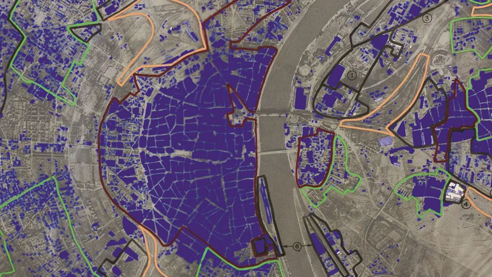
The dark blue shows the area destroyed or badly damaged: you can also find more information about the damaged city in my post on the geometry of destruction here (which includes an early target map).
Lauren’s report for the BBC includes similar maps for Berlin and Dresden.
