
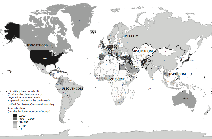
When I was working on my ‘War and peace’ essay (Trans Inst Br Geogr 35 (2010) 154–186; DOWNLOADS TAB) – which will appear, in radically revised and extended form, in The everywhere war – I included this map of US military bases outside the continental United States, based on David Vine‘s Island of shame: The Secret History of the U.S. Military Base on Diego Garcia (2009), which was in turn derived from the Pentagon’s 2007 Base Structure Report:
Various other versions are available around the web, but now – inspired in part by Trevor Paglen‘s Blank Spots on the Map – a new project by Josh Begley (of Dronestream fame) has worked from the 2013 Base Structure Report to produce a new base map supplemented by aerial/satellite imagery of more than 640 US military bases around the world.
It’s still a minimalist accounting, but the lacunae are produced not only by the secret installations that are systematically excluded from the Pentagon’s public accounting of what it calls its ‘real property’ – if only there could be a listing of its surreal property too (which is where Trevor comes in) – but also by the database’s predisposition towards permanence (of sorts). You’ll see what I mean if you zoom in on Afghanistan: the main Forward Operating Bases are there but none of the firebases and combat outposts scattered across the landscape. Still, even in this appropriately skeletal form, it’s a vivid reminder of the boots firmly planted on other people’s ground.
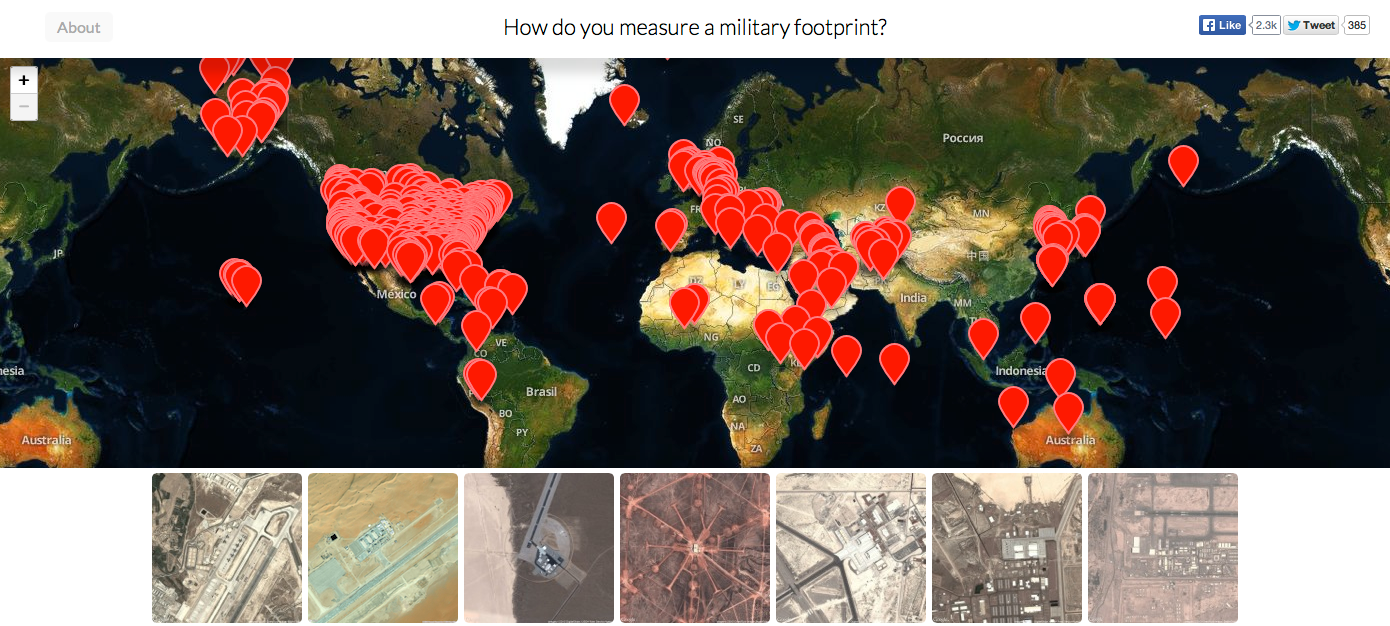
Josh includes a sharp-eyed commentary on the differences between images of the same site on different commercial platforms, and concludes his opening essay, ‘How do you measure a military footprint?’ like this:
Taken as a whole, I’d like to think this collection can begin to approximate the archipelago of militarized space often understood as empire. But I’m hesitant to say that. It seems to me that empire involves more than pushpins on a map. It is made up of human activity — a network of situated practices that preclude constellational thinking and sculpt geographies in their own image.
I’m not sure aerial photography can get at that complexity. But perhaps an outline of this footprint– of runways and bases and banal-looking buildings — might begin to chip away at the bumper-sticker simplicity much political discourse about the military-industrial complex gets reduced to.
A friend recently sent me this passage from Ananya Roy [‘Praxis in the time of Empire’, Planning Theory 5 (1) (2006) 7-29] that I’ve come to like quite a bit:
“The time of empire is war and destruction, but it is also creation, beauty, and renewal. The apparatus of empire is the military, but it is also architecture, planning, and humanitarian aid. The mandate of empire is to annihilate, but it is also to preserve, rebuild, and protect. Empire rules through coercion and violence, but it also rules through consent and culture.”
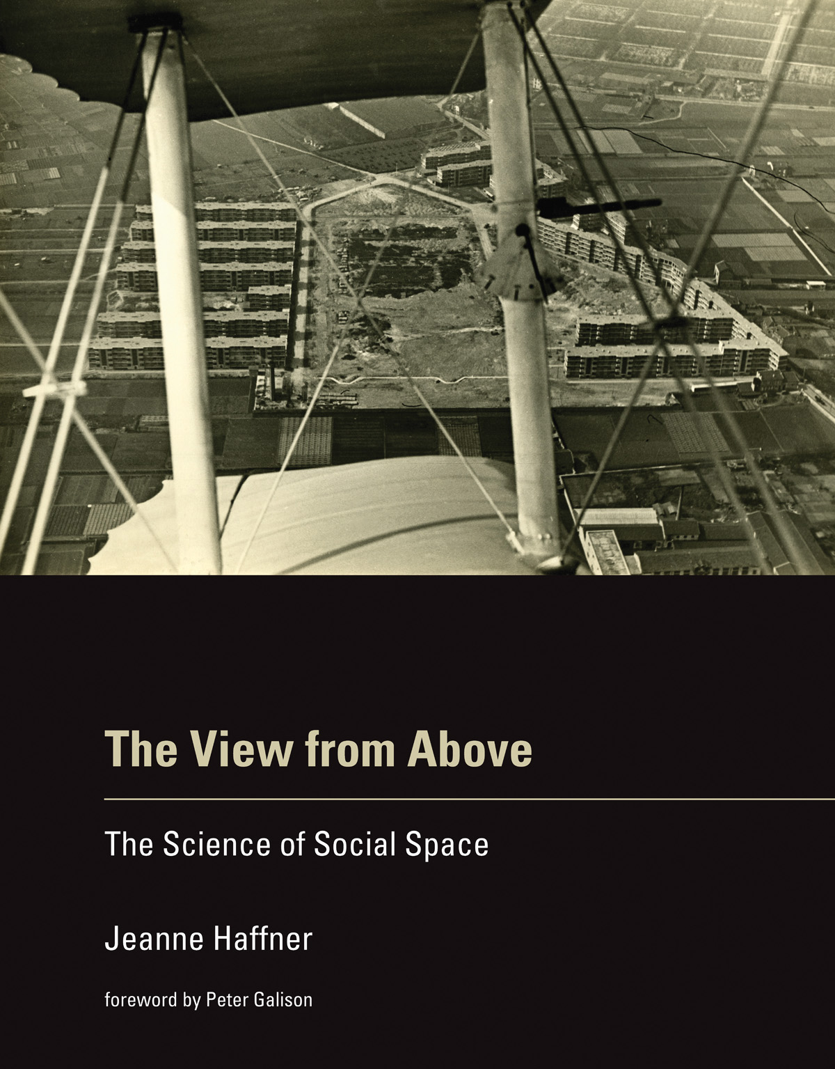 Two quick comments. First, if you want more on what aerial photography can get at – and in particular its historical formation as an indispensable vector of modern war – try Terrence Finnegan‘s Shooting the Front: Allied aerial reconnaissance in the First World War (2011), which has already established itself as a classic, or if you prefer a more theoretically informed survey, Jeanne Heffner‘s The view from above: the science of social space (2013), especially Chapter 3, ‘The opportunity of war’. War doesn’t loom as large as you’d think in Denis Cosgrove and William Fox‘s Photography and flight (2010), but you’ll also find interesting ideas in Paul Virilio‘s perceptive War and cinema. On satellite imagery, the most relevant essay for the background to this project is probably Chris Perkins and Martin Dodge, ‘Satellite imagery and the spectacle of secret spaces‘, Geoforum 40 (4) (2009) 546-60. The different platforms that Josh discusses (Google Earth and Bing) derive much of their imagery from DigitalGlobe: for an update on its new super-high res WorldView-3 (and its restriction to the US military and security apparatus), see Neal Ungerleider, ‘Google Earth, foreign wars and the future of satellite imagery’ here. Among her many important essays, Lisa Parks‘ ‘Zeroing in: overhead imagery, infrastructure ruins and datalands in Iraq and Afghanistan’ is an indispensable kick-start for thinking about satellite imagery and military violence, and you can find it in Jeremy Packer and Stephen Crofts Wiley (ed) Communication matters (2013) and in Nicholas Mirzoeff‘s Visual culture reader (3rd edition, 2013). One of my favourite essays – and the one that got me started on the intimate connections between political technologies of vision and military violence an age ago – is Chad Harris‘s ‘The omniscient eye: satellite imagery, “battlespace awareness” and the structures of the imperial gaze’, open access at Surveillance and society 4 (1/2) (2006) here.
Second, it is indeed important to think through all the ways in which the US military/security presence reaches beyond these pinpricks on the map. These are bases for more extensive military operations, obviously, but there is also the roving US presence in outer space, air and ocean – and cyberspace – that is necessarily absent from these static arrays. In addition – and there must be many other add-ons – the US is hardening its borders in a transnational space, confirming the argument made explicit in the 9/11 Commission report: ‘the American homeland is the planet’. Deb Cowen‘s seminal essay on ‘A geography of logistics’ is indispensable here, and Todd Miller provides a recent vignette on what he calls Border Patrol International here.
Oh – one more thing. Josh’s new project has been widely advertised – from Gizmodo through the Huffington Post to the Daily Mail (really) – but if you want to see whether you’re in step with other posters and the trolls, look at the comments sections. Sobering. Gizmodo is particularly revealing/depressing.

Pingback: Base lines and military projections | geographical imaginations
Pingback: Map and Satellite Pictures of United States’ Worldwide Secret Military Installations | Electronic Stalking Neuro Weaponry Terror