I’m in Copenhagen – and still bleary-eyed – for a symposium organised by my good friends Kirsten Simonsen and Lasse Koefoed at Roskilde on their current project ‘Paradoxical spaces: Encountering the other in public space‘. I’ll be talking about the war in Syria, drawing on my previous work on attacks on hospitals, healthcare workers and patients (see ‘Your turn, doctor‘) – which I’ve now considerably extended as I work on turning all this into a longform essay: I’ll post some updates as soon as I can – but now adding a detailed discussion of siege warfare in Syria. More on that in my next post; but for now I wanted to share some remarkable work on Aleppo by Laura Kurgan and her students at the Center for Spatial Research at Columbia:
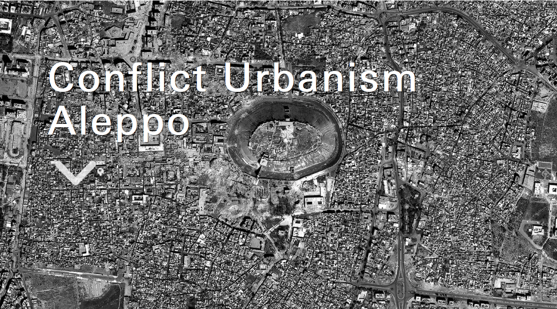
Conflict Urbanism: Aleppo is a project in two stages.
First, we have built an open-source, interactive, layered map of Aleppo, at the neighborhood scale. Users can navigate the city, with the aid of high resolution satellite imagery from before and during the current civil war, and explore geo-located data about cultural sites, neighborhoods, and urban damage.
Second, the map is a platform for storytelling with data. We are inviting collaborators and students to bring new perspectives and analyses into the map to broaden our understanding of what’s happening in Aleppo. Case studies will document and narrate urban damage — at the infrastructural, neighborhood, building, social, and cultural scales — and will be added to the website over time.
We invite ideas and propositions, and hope to build on the data we have compiled here to create an active archive of the memory of destruction in Aleppo through investigation and interpretation, up close and from a distance.
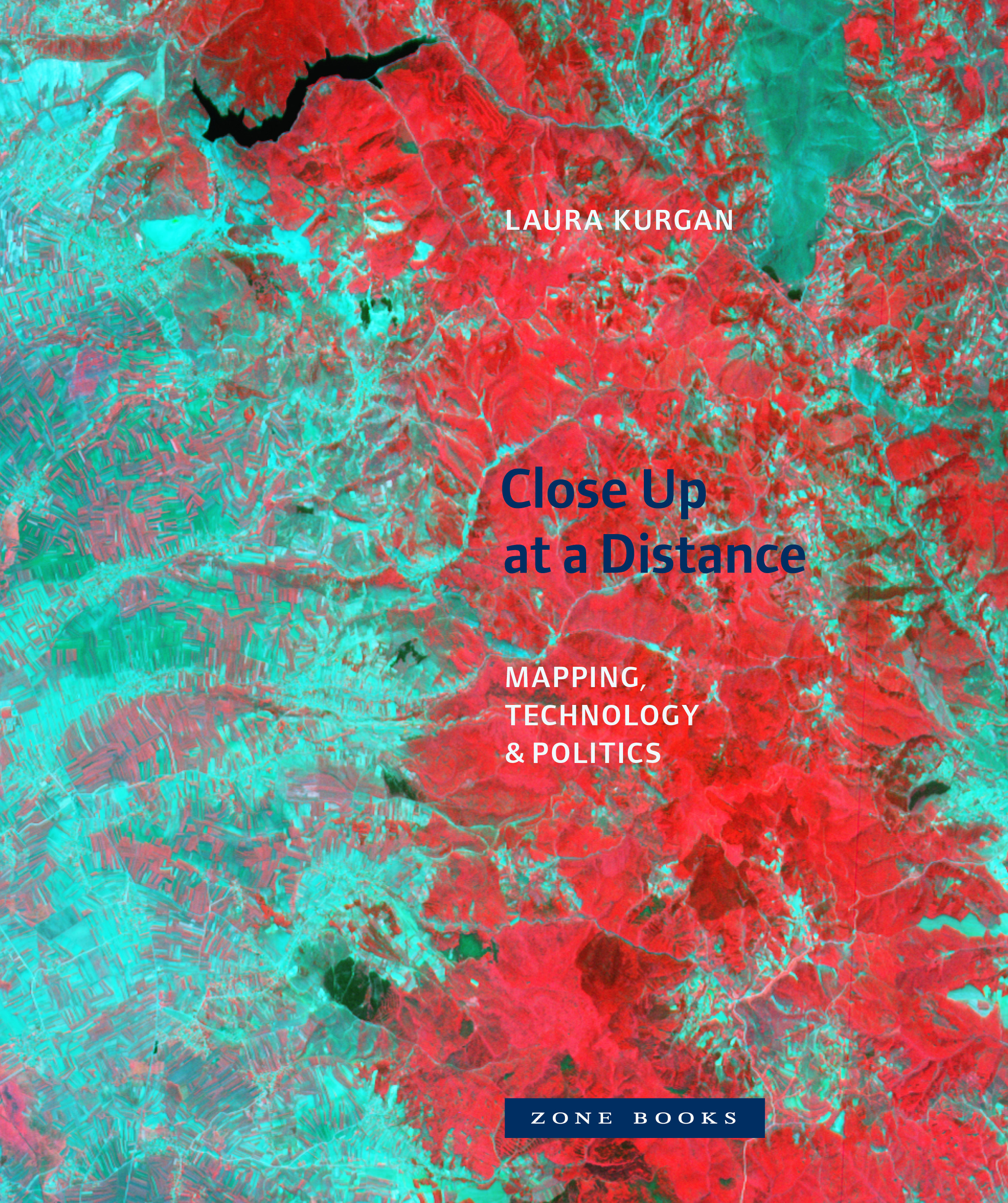
 That last phrase is an echo of Laura’s book, Close Up at a Distance: Mapping, Technology and Politics, published by MIT in 2013. The new project emerged out of a seminar taught by Laura in 2016:
Students worked collaboratively to develop a series of case studies using a map developed by the Center for Spatial Research, specifically designed to research urban damage in Aleppo during the ongoing civil war. Their work incorporates a range of disciplines, methods and results. Each student was asked to create case studies and add layers to the existing map. The results — spatializing youtube video, interior borders between fighting factions, imagining urban survival during wartime, imaging escape routes, audio memory maps, roads, water, hospitals, informal neighborhoods, religion, communications infrastructure, and refugee camps at the borders — are [available online here].
I’m particularly taken by ‘Spatializing the YouTube War’. One of the challenges for those of us who follow these events ‘at a distance’ is precisely how to get ‘close up’; digital media and the rise of citizen journalism have clearly transformed our knowledge of many of today’s conflict zones – think, for example, of the ways in which Forensic Architecture has used online videos to narrate and corroborate Russian and Syrian Arab Air Force attacks on hospitals in rebel-held areas Syria; similarly, Airwars has used uploaded videos for its painstaking analysis of US and coalition airstrikes and civilian casualties (see this really good backgrounder by Greg Jaffe on Kinder Haddad, one of the Airwars team, ‘How a woman in England tracks civilian deaths in Syria, one bomb at a time‘) – and I’ve used similar sources to explore the effects of siege warfare on Aleppo, Homs and Madaya.
Here is how Laura and her students – in this case, Nadine Fattaleh, Michael James Storm and Violet Whitney describe their contribution:
The civil war in Syria has shown how profoundly the rise of cellphones with video-cameras, as well as online video-hosting and emergent citizen journalism, has changed the landscape of war documentation. YouTube has become one of the largest sources (and archives) of information about events on the ground in Syria: since January 2012 over a million videos of the conflict there have been uploaded, with hundreds of millions of views to date. Major news agencies have come to rely on YouTube as a primary source for their reporting, and human rights organizations often cite videos as part of their advocacy and documentation efforts. This independently reported footage has created a new powerful archive, but opens up crucial questions of credibility, verification, and bias. As with all data, every video comes to us bearing the traces of the situation and intentions that motivated its production. This does not disqualify it – quite to the contrary – but it does demand that we approach everything critically and carefully.
We set out to investigate YouTube as archive of the Syrian uprising and to develop a method for organizing that archive spatially. We used the frameworks that we had developed for the Conflict Urbanism Aleppo interactive map, together with a naming convention used by Syrian civic media organizations, in order to sort and geolocate YouTube videos from multiple sources. We then produced a searchable interactive interface for three of the most highly cited YouTube channels, the Halab News Network, the Aleppo Media Center, and the Syrian Civil Defense. We encourage journalists, researchers, and others to use this specifically spatial tool in sorting and searching through the YouTube dataset.
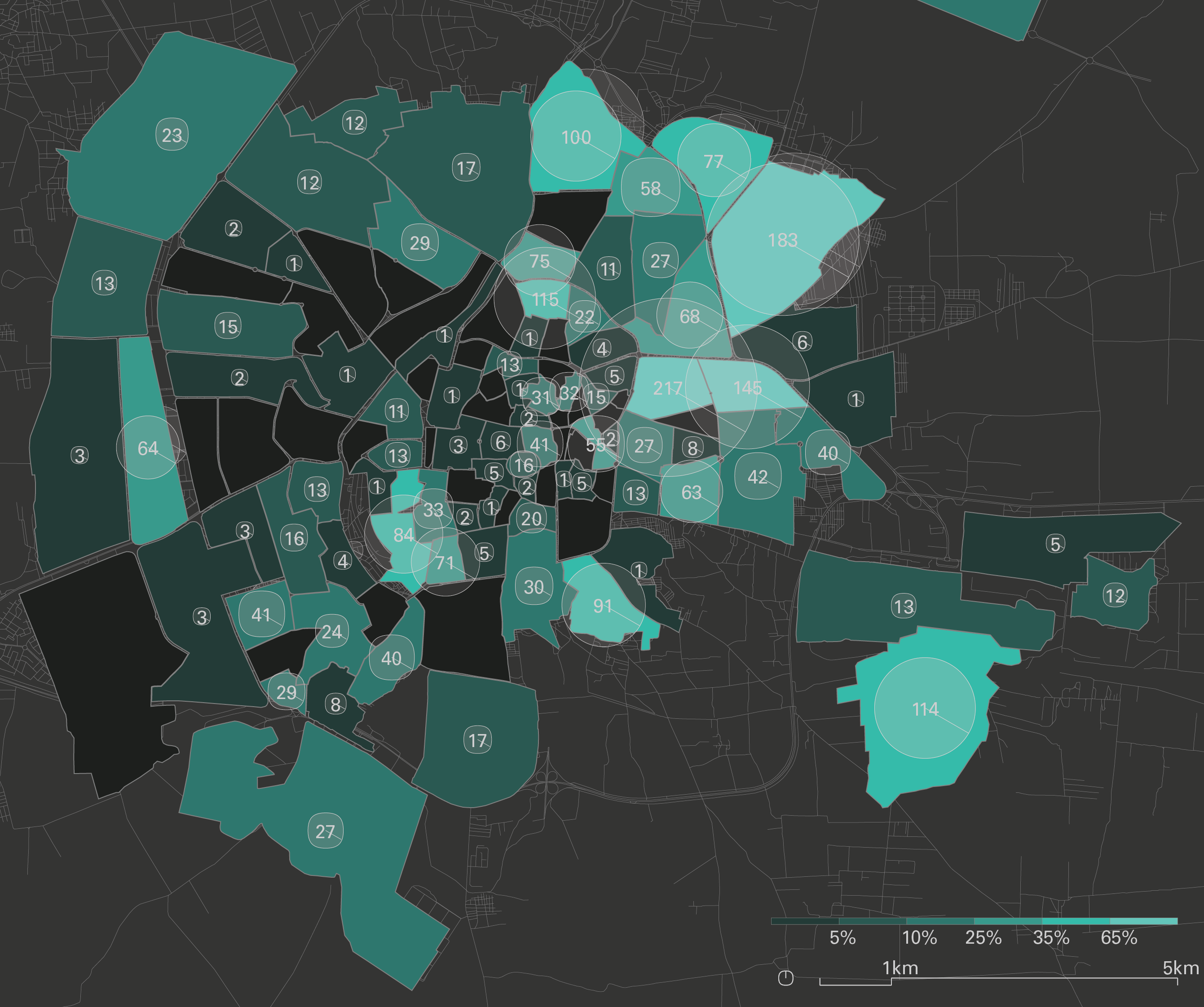
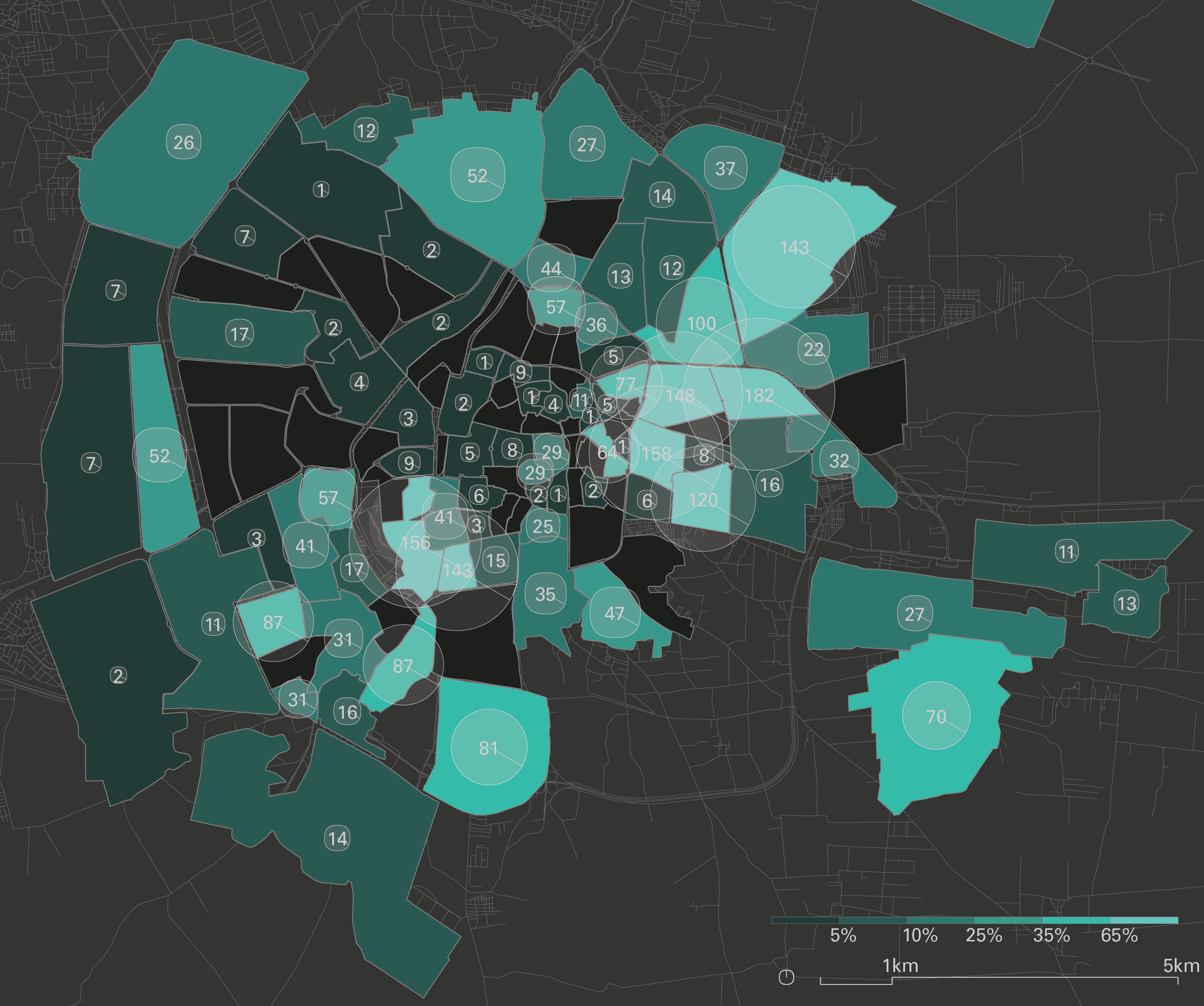
The Halab News Network [above] shows a wide distribution of videos across the city, including the city center and government-held Western side of the city. The Eastern half of the city — in particular the Northeastern neighborhoods of ash-Sha’ar (الشعار), Hanano (هنانو), and Ayn at-Tal (عين التينة) – is the best-documented.
In contrast:
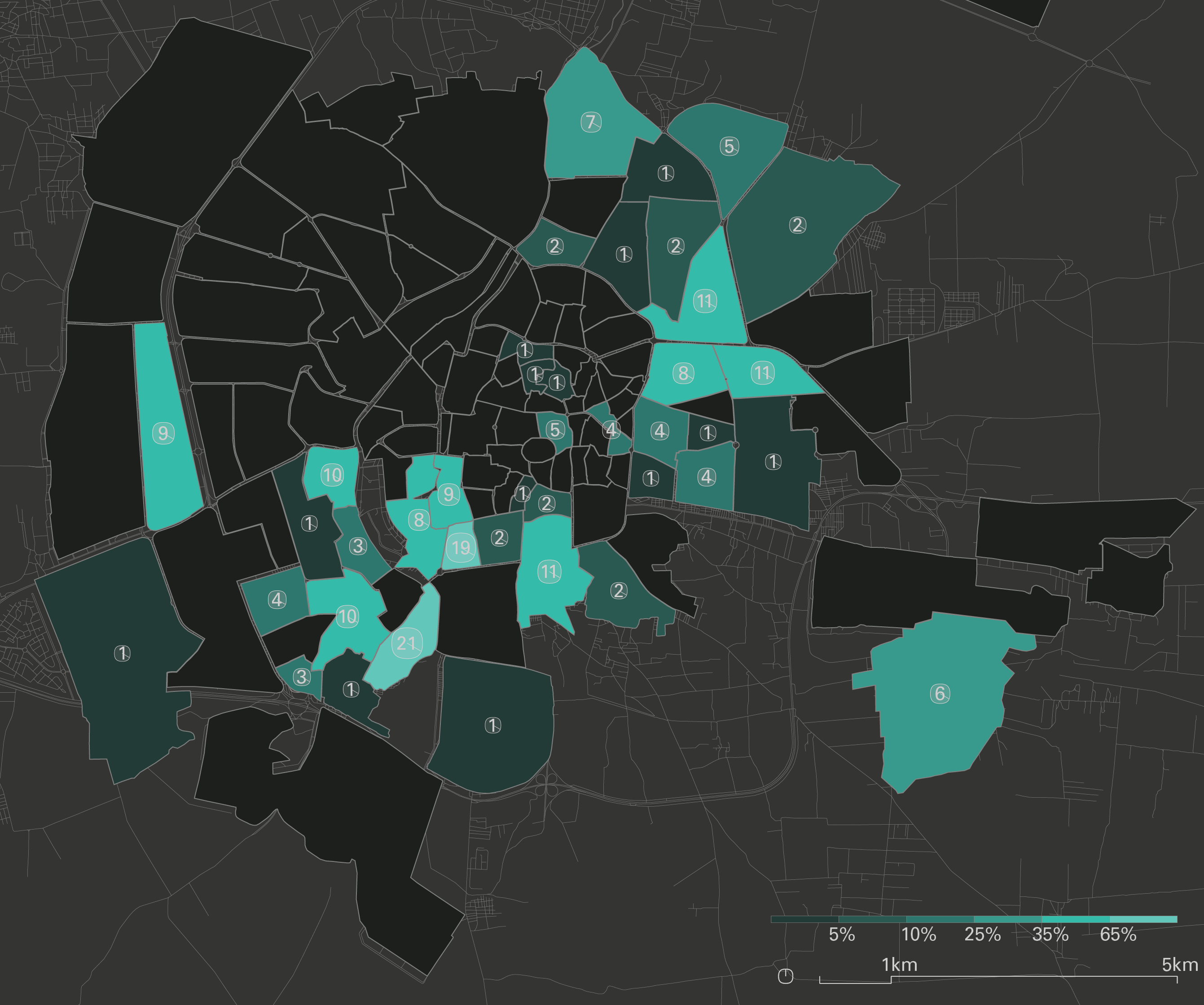
The videos published by the Aleppo Media Center [above] roughly follow the formerly rebel-held Eastern side of the city, with a small number of videos from the central and Western areas. The highest number of videos is in the neighborhood of ash-Sha’ar (الشعار). Particular spots include ash-Sha’ar (الشعار), coverage of which is shared with the Syrian Civil Defense. Another notable concentration are two neighborhoods in the Southwest, Bustan al-Qaser (بستان القصر) and al-Fardos (الفردوس).
They also analyse the video geography produced by the White Helmets [below]: ‘The Syrian Civil Defense, also known as the White Helmets, have uploaded videos primarily in the formerly rebel-held Eastern and Southern areas of Aleppo. Only the Western area of ash-Shuhada’ (الشهداء) falls outside of this trend.’
This, like the other collaborative projects under the ‘Conflict Urbanism’ umbrella, is brilliant, essential work, and we are all in their debt.
You can read more about the project in a short essay by Laura, ‘Conflict Urbanism, Aleppo: Mapping Urban Damage’, in Architectural Design 87 (1) (2017) 72-77, and in another essay she has written with Jose Francisco Salarriaga and Dare Brawley, ‘Visualizing conflict: possibilities for urban research’, open access download via Urban Planning 2 (1) (2017) here [this includes notice of a parallel project in Colombia].