Life in the Age of Drone Warfare

national-bird-still-woman

[Still image from NATIONAL BIRD © Ten Forward Films]

Here is the Contents page from Lisa Parks and Caren Kaplan (eds) Life in the Age of Drone Warfare, due from the wonderful people at Duke University Press later this year.

Introduction – Lisa Parks and Caren Kaplan 

I. Juridical, Genealogical and Geopolitical Imaginaries

1. Dirty Dancing: Drones and Death in the Borderlands – Derek Gregory 35

2. Lawfare and Armed Conflicts: A Comparative Analysis of Israeli and US
Targeted Killing Policies – Lisa Hajjar 91

3. American Kamikazes: Television-Guided Assault Drones in World War II
Katherine Chandler 139

4. (Im)material Terror: Incitement to Violence Discourse as Racializing Technology
in the War on Terror – Andrea Miller 175

5. Vertical Mediation and US Drone War in the Horn of Africa – Lisa Parks 211

II. Perception and Perspective

6. Drone-o-Rama: Troubling the Temporal and Spatial Logics of Distant Warfare – Caren Kaplan 242

7. Dronology: Or Four Twice Told Tell Tales – Ricardo Dominguez 268

8. In Pursuit of Other Networks: Drone Art and Accelerationist Aesthetics – Thomas Stubblefield 292

9. The Containment Zone – Madiha Tahir 322

10. Stoners, Stones and Drones: Transnational South Asian Visuality from Aboveand Below – Anjali Nath 356

III. Biopolitics, Automation and Robotics

11. Taking People Out: Drones, Media/Weapons and the Coming Humanectomy – Jeremy Packer and Josh Reeves
383

12. The Labor of Surveillance and Bureaucratized Killing: New Subjectivities of Military Drone Operators – Peter Asaro 415

13. Letter from a Sensor Operator – Brandon Bryant 465

14. Materialities of the Robotic – Jordan Crandall 478

15. Drone Imaginaries: The Techno-Politics of Visuality in Postcolony and Empire – Inderpal Grewal 506

And here are two responses to the book:

“As the presence of the drone in public imaginaries expands, its military/imperial paternities are overshadowed while the modes of violence that drone operations enable are progressively normalized. This thoughtfully curated collection definitively interrupts those trajectories. Putting the drone in its geopolitical place, it traces drone genealogies through histories of surveillance and killing from above, to the colonial presents in which we are all implicated, and that we need now more than ever to stand against.” — Lucy Suchman, Lancaster University, UK

“Life in the Age of Drone Warfare is an intoxicating whirlwind of a volume explicating the drone in history, law, culture and geopolitics. Lisa Parks and Caren Kaplan steer the way through an incisive feminist and critical lens partnered with startling material evidence. We find the drone coiled within matrices of relations, both distant and intimate, calculative, legal and bureaucratic, yet embodied and affective. Twisted in not only a vertical but vortical kind of power, the drone winds, distorts, corkscrews and strangles—rewriting worlds as it goes.” — Peter Adey, Royal Holloway, University of London

You can find a longer version of my chapter under the DOWNLOADS tab.

Counter-mapping and ecologies of military power

ecologies-of-power

Just caught up with Ecologies of Power by Pierre Bélanger and Alexander Arroyo (MIT Press), which – as the subtitle reveals – is a fascinating countermapping of the Pentagon’s logistical landscapes and military geographies:

This book is not about war, nor is it a history of war. Avoiding the shock and awe of wartime images, it explores the contemporary spatial configurations of power camouflaged in the infrastructures, environments, and scales of military operations. Instead of wartime highs, this book starts with drawdown lows, when demobilization and decommissioning morph into realignment and prepositioning. It is in this transitional milieu that the full material magnitudes and geographic entanglements of contemporary militarism are laid bare. Through this perpetual cycle of build up and breakdown, the U.S. Department of Defense –the single largest developer, landowner, equipment contractor, and energy consumer in the world – has engineered a planetary assemblage of “operational environments” in which militarized, demilitarized, and non-militarized landscapes are increasingly inextricable.

In a series of critical cartographic essays, Pierre Bélanger and Alexander Arroyo trace this footprint far beyond the battlefield, countermapping the geographies of U.S. militarism across five of the most important and embattled operational environments: the ocean, the atmosphere, the highway, the city, and the desert. From the Indian Ocean atoll of Diego Garcia to the defense-contractor archipelago around Washington, D.C.; from the A01 Highway circling Afghanistan’s high-altitude steppe to surveillance satellites pinging the planet from low-earth orbit; and from the vast cold chain conveying military perishables worldwide to the global constellation of military dumps, sinks, and scrapyards, the book unearths the logistical infrastructures and residual landscapes that render strategy spatial, militarism material, and power operational. In so doing, Bélanger and Arroyo reveal unseen ecologies of power at work in the making and unmaking of environments—operational, built, and otherwise—to come.

orbital-urbanization

Here is the legendary Claude Raffestin on the project:

Among its remarkable achievements, Ecologies of Power offers a new way of analyzing and representing the complex apparatus commonly called ‘war’ through its military infrastructures, logistical territories, and the material, energetic, informational, and financial flows that make and move through them. Deftly traversing a multitude of scales and landscapes, the book mobilizes a vast body of transdisciplinary work on the complex subject of power and its modes of spatial and semiotic representation. This ambitious and long-awaited volume is an essential reference for all scholars across the arts and sciences whose work aims to rethink how we engage—and disengage from—contemporary forms of conflict.

You can get an illustrated preview from Regine at We make money not war here.  She lists the book’s five core case studies:

  • The first case study is Diego Garcia, an atoll in the Indian Ocean. Strategically located between East Africa, the Middle East and Southeast Asia, the atoll is a vital anchor for the Afghanistan campaign and for supplying US naval forces with fuel.

fuel-chain

  • A second case looks at the high number of blast trauma and death from improvised explosive devices in the Helmand Valley and investigates the intimate connections between the use of IED by local groups and the production and movements of opium.
  • The third case study… looks at nutritional politics and at DoD’s surveys of rare earths and other high-volume minerals in the territories the U.S. attempts to control.
  • A fourth case study explores the complexities and ‘indeterminacies’ inherent to technological systems such as drones.
  • The last case study zooms in on Washington D. C.’s landscape of defense apparatus.

The images I’ve used here are from the Graham Foundation‘s webpage on the project.

Data.mil

Four years ago I described Project THOR (Theatre History of Operations Reports), Lt Col Jenns Robertson‘s remarkable attempt to transcribe, standardise and integrate the available records of US Air Force strike missions – see here (scroll down) and (especially) here.

His databases have now been incorporated into Defense Digital Service‘s  data.mil, described as ‘an attempt in open defence data’: it’s also an experiment, which invites not only use but interaction and comment.  You can now access the THOR databases – and find the backstory – here.

In 2006, Lt Col Jenns Robertson and his team in the Pentagon faced a daunting task. Every week, the Air Force’s Chief of Staff and other senior military officers would ask for the latest on the air war in Iraq and Afghanistan – how many aircraft had flown that week, which ground units they supported, and what munitions they had dropped.

Working in the Air Force’s Operations Directorate, Robertson had access to a wide array of classified data sources, yet the weekly report was tedious to produce.  Data was not easily searched and often contained only half the picture, forcing Robertson’s team to assemble the report manually every week over the course of several days. He knew there was an easier way.

In his spare time, Robertson began creating the Theater History of Operations Reports (THOR), initially a simple Excel spreadsheet that eventually matured into the largest compilation of releasable U.S. air operations data in existence. Robertson tested his database with his team, asking them to generate the Chief’s weekly report twice — once manually, and again using THOR. The result was impressive: THOR cut the report work from three days to just under an hour.

After receiving Department of Defense approvals, Robertson was able to post THOR files online so interested public citizens could search the data for their own purposes. Robertson understands the vast potential benefits of opening such a large compilation of previously inaccessible data to the public. “I can’t envision all the ways this can be used”.

One of the first (once forbidden) fruits of releasing this data to the public is a remarkable map by Cooper Thomas plotting 3.1 million US bombing and ground attack missions (including Close Air Support and aerial interdiction) in North and South Vietnam, Laos and Cambodia between 1966 and 1974:

vietnamwarbombing-01

Cooper promises further explorations of this and other THOR databases; if you know of any others, please let me know [see UPDATE below].

Data.mil is promising to release a new ‘data story’ each month – next month should see the release of a military casualty database.  The site went live in December 2016, and  Mary Lazzeri and Major Aaron Capizzi explain the background:

Mary:  Major Aaron Capizzi, USAF had the idea to use open data principles to solve Department of Defense (DoD) problems after attending a panel discussion at the Harvard Kennedy School sponsored by former Deputy CTO, Nick Sinai. In addition, I had been looking to seed an open data effort at DoD. Aaron’s idea, coupled with the opportunity to present the Theater History of Operations (THOR) bombing data in a new and interesting way, provided a perfect opportunity to put energy behind the effort.

We’re looking to use this pilot to jumpstart a larger open data effort at DoD. The beta site is a working proof-of-concept. The next step is to show the larger DoD community that open data merits investment.

Aaron: Our approach is unique in two ways. First, Data.mil will test various ways of sharing defense-related information, gauging public interest and potential value, while protecting security and privacy. We will quickly iterate and improve the data offerings on data.mil, using public feedback and internal department discussions to best unlock the value of defense data. Our goal is to provide all data with enough context that users, both the public and defense employees, can understand the potential value and get started using data quickly.

Second, Data.mil will prioritize opening data using a demand-driven model, focusing on quality rather than standard quantity metrics. The Department of Defense regularly reports on the significant challenges we face in defending the nation, which range from attracting talented recruits to developing game-changing technology within constrained budgets. Most of these aspects of defense business generate large amounts of unclassified data which, if released, can encourage collaboration and innovation with public and private sector partners.

Mary: The site is built using an open data storytelling platform, LiveStories. Rather than simply posting a list of datasets, the goal of Data.mil is to tell stories with data. The site provides narratives to complement the data so users can more quickly understand and begin using it. LiveStories was selected for its visualization and data analysis features allowing us to present an engaging site for its users. In addition, it’s easy to use. Non-technical staff can use the platform to share their data and tell their stories.

We want to compel collaboration from military components, industry partners and the public. The partnership with data.world enables that collaboration providing the social media tools to support exploration and a community discussion of the data.

Conversely, it’s also worth thinking about how digital platforms are now used to plan and execute air strikes.  As the origins of Project THOR show, there are crucial links between retrospective reporting and prospective mission planning.

UPDATE:  I’ve since discovered this map of Allied bombing raids over Europe in the Second World War by Dimitri Lozeve, also drawn from Data.mil’s THOR database (click on the link for an enlarged version):

Allied bombing in Europe, 1939-1945

You can zoom in; here are two close-ups:

screen-shot-2017-01-18-at-12-35-23-pm

screen-shot-2017-01-18-at-12-38-26-pm

The map comes without a key; all I know is that the original tabulations include ‘U.S. and Royal Air Force data, as well as some Australian, New Zealand and South African air force mission’ 1939-1945 and refer to tonnages dropped: more discussion here.

On the global scale, Data Is Beautiful has a GIF showing ‘every bomb dropped by Allied forces in World War II); you can view it as a video here, from which I’ve grabbed these screenshots that capture the shift from the European to the Pacific theatre:

allied-bombing-october-1940

allied-bombing-june-1943

allied-bombing-june-1944

allied-bombing-november-1944

allied-bombing-june-1945

Data World‘s Ian Greenleigh has kindly alerted me to a similar treatment of the THOR database for Vietnam by his colleague Mark DiMarco here:

Our point-of-view is from high above the South China Sea, where much of the US Navy fleet was stationed.
By giving the user a bird’s eye view, we can clearly see up and down the Vietnamese peninsula, and the neighboring countries of Laos & Cambodia, and precisely see where these missions took place.
Each frame of the visualization is a single day’s worth of missions. Some days had as many as 1,500 missions, while the records for some days are completely missing.
The colors of each of the circles dictates what type of mission took place.

The GIF is here; screenshot from the interactive:

Vietnam bombing GIF

Striking Syria

screen-shot-2017-01-17-at-11-48-35

The Syrian-American Medical Society (SAMS) has published a grim report documenting the pattern of attacks on healthcare in Syria following the passage of UN Security Council Resolution 2286 on 3 May 2016 condemning attacks on medical facilities and personnel in conflict zones.  The Resolution was a general one; several states drew attention to Israel’s assault on medical facilities in Gaza, and to the US airstrike on the MSF Trauma Centre in Kunduz (Afghanistan) (see here and here).

The Resolution had the urgent support of a host of humanitarian NGOs; it was co-sponsored by more than 80 member states, and it was adopted unanimously by the Security Council.  At the time the UN Secretary-General Ban Ki-Moon described attacks on hospitals as a war crime, and declared:

When so-called surgical strikes are hitting surgical wards, something is deeply wrong… Even wars have rules…  The Council and all Member States must do more than condemn such attacks. They must use every ounce of influence to press parties to respect their obligations.

msf-at-the-un

And yet this is what SAMS found in Syria:

  • In 2015, the rate of targeting of medical facilities and personnel was one attack every four days.
  • In October 2015, following Russia’s intervention in support of the Syrian government, this rate doubled to one attack every 48 hours.
  • In November 2016 the rate virtually doubled again to one attack every 29 hours.

SAMS estimates that there were 252 attacks on medical facilities and personnel in 2016; 199 of them took place after the passage of UNSC Resolution 2286.

Between June and December  SAMS identified 172 attacks (all detailed in an appendix to the report): 168 of them were carried out by the Syrian government and its allies; one by non-state opposition forces; one by Islamic State; and two by unidentified parties.  Aleppo and Idlib were the principal targets: eastern Aleppo alone received a numbing 42 per cent of all attacks.

In case you are wondering about the sources for these claims, the report explains:

SAMS maintains rigid documentation standards in collaboration with partners in the WHO Health Cluster in Turkey and the Johns Hopkins University Bloomberg School of Public Health’s Center for Health and Human Rights. Our reporters on the ground rely on rst- hand testimony and photo documentation from medical sta and record the date, time, location, damages, casualties, impact on service delivery, weapon(s) used, and perpetrator of each incident. Any other source of information is not considered.

syria-attacks-graphics-03_page_6-e1484145301958

Dr Ahmad Tarakji, President of SAMS, reaches this bleak and compelling conclusion:

The failure of the international community to hold the perpetrators of these attacks accountable sends a dangerous message: that there are no lines, no limits, and no boundaries to the atrocities that are being committed against the Syrian people.

You can find more details about the targeting of doctors and hospitals in my post on the weaponisation of healthcare in Syria here; there is also a response to the passage of UNSC Resolution 2286 and its implementation by the Safeguarding Health in Conflict coalition (in September 2016) here.

Meanwhile Chris WoodsAirwars team has just released its preliminary assessment of civilian casualties from air strikes carried out by the US-led coalition and by Syrian/Russian air forces:

Syria’s civilians were under constant threat from Coalition air strikes throughout 2016, with 38% more casualty events reported in Syria than Iraq over the year. This may however reflect improved local reporting by Syrian monitors.

Overall, minimum likely civilian deaths in Syrian incidents graded by Airwars as Fair or Confirmed doubled in 2016. Across 136 incidents, between 654 and 1,058 civilians were claimed killed in total. Airwars estimates that a minimum of 818 civilians were likely injured in Fair and Confirmed events in Syria alone.

There were major spikes in February, in June and July (the Manbij campaign) and November the Raqqa campaign), all of them focused on areas held by Islamic State.

As for Syrian/Russian air strikes:

Airstrikes carried out by Moscow pummeled rebel-held areas of Syria throughout 2016, with many hundreds of civilians credibly reported killed.

Overall, there were 1,452 separate claimed civilian casualty events allegedly carried out by Russia during 2016. Between 6,228 and 8,172 civilians reportedly died in these events. Many of these incidents are likely to have been the result of actions by the Assad regime. Even so, civilian deaths from Russian strikes in 2016 far outpaced those from Coalition actions.

The pattern of civilian casualties from Russian air strikes:

screen-shot-2017-01-17-at-12-11-37

But at least three caveats are necessary.  First, these are provisional calculations:  ‘With so many allegations to assess, Airwars has a significant case backlog’, and the team has so far only completed a detailed analysis of the first four months of 2016.

Second, the report provides no separate listing of air strikes carried out by the Syrian Arab Air Force. The Airwars team concedes a ‘very high level of confusion – especially between Russia and the regime’.  Here is Kinda Haddad: ‘For many incidents we have some sources blaming the regime and others Russia – and we can’t really tell who is responsible as they use similar planes and weaponry.’  One major exception to that must be the use of barrel bombs dropped by the SAAF’s helicopters.

Third, these tabulations identify immediate casualties from the strikes: one of the reasons for attacking doctors and hospitals, as I explained previously, is to multiply subsequent and distant casualties – to deny those wounded (or simply sick) life-saving medical treatment.  So these casualty lists are minima – and not only as a result of the general problems of casualty accounting in conflict zones.

Counting casualties and making casualties count

In my analysis of CIA-directed drone strikes in Pakistan’s Federally Administered Tribal Areas (see ‘Dirty Dancing’: DOWNLOADS tab) I drew upon the tabulations provided by the Bureau of Investigative Journalism and Chris Herwig‘s cartographic animation of casualties between 2004 and 2013: see my discussion here and the maps here.

Quartz’s CityLab is now running a week-long series on Borders (‘stories about places on the edge’) and it includes a new series of interactive maps showing civilian casualties from drone strikes in the FATA (this series also ends in 2013).  Here’s a screenshot:

screen-shot-2017-01-13-at-21-04-37

There’s not much geographical analysis – apart from noting the focus on North and South Waziristan – and, as I argued before, I think it a mistake to isolate drone strikes from the wider matrix of military and paramilitary violence in the borderlands (including air strikes by the Pakistan Air Force).  And there are obvious problems in disentangling civilian casualties – the US Air Force has the greatest difficulty in identifying civilians in the first place.

It’s difficult to put all this together – and particularly to hear the voices of those caught up in a matrix of such extensive violence that, as Madiha Tahir puts it so well, ‘war has lacerated the land into stillness.’  In an exquisite essay in Public Culture 29 (1) (2017) Madiha reflects on that difficulty and the ‘spatial stories’ local people struggle to tell.  Her title – ‘The ground was always in play’ – is borrowed from Michael Herr‘s despatches from Vietnam, but the full quotation explains how aerial violence echoes across this shattered land:

‘The ground was always in play, always being swept.  Under the ground was his, above it was ours.  We had the air.’

But the ‘we’ in the FATA is plural – a product of the ‘dirty dancing’ between Washington and Islamabad – and so we come to the story Madiha pieces together:

The story Mir Azad came to tell is this [and, as Madiha shows, he had travelled 500 difficult miles across South and North Waziristan to tell it]. In July 2015, American drones bombed and killed two of his cousins, Gul Rehman Khan and Mohammad Khandan. After Zarb-e-Azb began in June 2014, thousands of Waziris fled in all directions, businesspeople, farmers, militants, and students, including to the Pakistani villages in Barmal, and there the drones followed. The military operation and the “surgical” operation, carpet bombing and “precision strikes,” coordinated maybe, intentionally or not, they worked together to redraw the lines of movement, new containment zones, a shockwave that could start with ground troops in North Waziristan and end with a drone bombing a car in Barmal [in Paktika province, on the border with North Waziristan].

My extract can’t do justice to the essay: do read it if you can.

Since I completed the original version of ‘Dirty Dancing’ a number of new reports from Waziristan have provided more details of the co-ordination of air/ground operations.  Over the summer AFP reported that the Pakistani military had removed the roofs of houses to provide a better ‘aerial view’:

“(The) military has removed the roofs of the houses to have a better aerial view and stop militants taking refuge in these abundant, fort-like mud houses,” the official told reporters.  From the helicopter journalists could see scores of homes with no roofs but appearing otherwise intact, their interiors exposed to the elements.

roofs-removed-in-south-waziristan-2016

But in many cases – especially in North Waziristan – those ordered by the military to leave their homes have returned to find them reduced to rubble.

miran-shah-and-mir-ali-2015-001

miran-shah-and-mir-ali-2015-002

Earlier this month Ihsan Dawar reported from North Waziristan on ‘Life on the debris of wrecked houses’:

Murtaza Dawar sat with his children and cousins on the debris of his house. Behind him the setting sun was a ball of fire in the sky, reducing him and his family to silhouettes, the shards of glass in the wreck of his house catching the light and winking in the gathering dark of an early evening.

Coming back home to Mirali in North Waziristan has been a bittersweet experience for Dawar, 48. Sweet because he and his family has returned home after more than two years of displacement. Bitter, because they have come back to wreckage where their home was.

“We have nothing to do with militancy or Talibanization but our house has been demolished,” says Dawar, taking a break from pitching a tent. “There is not a single room intact. I don’t know where to take my family to protect them from the terrible cold.”

Dawar’s is not the only house that was razed during the military operation Zarb-e-Azb, launched in June 2014 to clear North Wazristan of militants. Of the nearly million tribesmen displaced by the operation, many have lost not only their belongings and assets they left behind in the tribal district and their houses have been demolished for no reason.

The government has not issued any clear data on the number of houses demolished in North Waziristan. In May 2016, a property damage survey conducted by the Fata Disaster Management Authority (FDMA) revealed that 11,663 houses were fully and partially damaged during operations against militants in South Waziristan, North Waziristan and the Khyber Agency.

Local tribesmen working in the political administration’s office in North Waziristan told Truth tracker on condition of anonymity – because of the sensitivity of information – that about 1500 houses were completely destroyed in the Mirali subdivision alone.

a-house-in-hurmaz-village

Cartographic animations can’t capture these in-animations, but we must surely do our best to attend to them.

Topographies of Mass Violence

montreal-museum-of-contemporary-arts-day

I’ve agreed to speak at the Max and Iris Stern International Symposium on Topographies of Mass Violence to be held at the wonderful Musée d’art contemporain de Montréal (MAC) (above) 31 March 31/1 April 2017.

We’re still figuring out what I might do, but here is the general description of the symposium.  More details when I have them.

The 11th annual Max and Iris Stern International Symposium, Topographies of Mass Violence, will be held at the Musée d’art contemporain de Montréal on March 31 and April 1, 2017, accompanying the shows Mundos by Mexican artist Teresa Margolles and Now Have a Look at this Machine, by Quebec artist Emanuel Licha. The symposium will address the phenomena of mass violence and the ways in which it is intimately linked to the territories and spaces in which it is perpetrated, but also the spatial and architectural arrangements through which it is mediated.

Mass violence is defined as violence by a government or organized group against certain members of a community or an entire population (members of an ethnic, religious or sexual community, inhabitants of a country). It encompasses violence against a few individuals to several hundred thousand victims: shootings, terrorist acts, feminicides, armed conflict, genocide. While there has always been mass violence, with war being one of the most common manifestations, since the early 1990s the nature of such violence as well as its modes of appearance and representation have changed. Far from making the world a peaceful place, the end of the Cold War and the opening of political, cultural and commercial borders has resulted in ongoing war, even in the heart of Europe, and a resurgence of the oldest forms of mass violence (such as genocide and ethnic cleansing in Rwanda and the Balkans). Recent decades have also been marked by an increase in certain types of mass violence: against women (the Polytechnique massacre, killing of First Nations women), against sexual communities (the shooting in Orlando, murders of transgender people), against Blacks (police violence) and even against certain social and occupational categories (Charlie Hebdo journalists, Mexican students). Climate change—which has its roots in political decisions about territorial management and is often closely intertwined with conflict—is also a source of broad-scale violence against civilian populations, provoking major movements of people which has in turn resulted in government attempts to impose spatial management on individuals (border walls, refugee camps, apartheids).

The ways in which these phenomena are represented has also undergone major transformations since the early 1990s. The first Gulf War marked the start of an intensive production of images of conflict, leading to tight governmental controls on their dissemination. Later, the advent of the Internet and social media allowed new actors to get involved in producing and disseminating such images, including amateur reporters and victims, but also perpetrators, in a trend toward the spectacularization of group killings: the September 11 attacks, the macabre scenes staged by Mexican drug cartels and the executions filmed by the Islamic State.

In this symposium, an international group of specialists in a variety of disciplines (historians of art, architecture and urban planning, of film and media, as well as architects, artists, activists and curators) will address these phenomena and suggest ways to think about them that go beyond their traditional representations in the media. Their contributions will help us imagine how the investigation of certain spatial artefacts inherent to architecture, city planning or military tactics can lead to a better understanding of these forms of violence.

Mapping, forensic architecture and visual cultures provide tools for conducting such spatial investigations, and certain artistic practices associated with these inquiries seek to offer alternative modes of representation. To escape the media polarization of unrepresentability/spectacularization, but also to counter government erasure and denial of mass violence, many artists take on the role of topographer by recording and representing the traces of this violence in the places where it has been directly or indirectly inscribed. Whether this involves territories where the violence has occurred (such as the Syrian, Iraqi and Libyan deserts; the Highway of Tears in British Columbia and Downtown Eastside in Vancouver;Ciudad Juárez and adjacent neighbourhoods), the evidence that remains (mass graves, destroyed cities, abandoned houses …) or the architectural structures which have made the representation and mediatization possible (war hotels …), mass violence is inseparable from topos.

muro-ciudad-jaurez-2010

Margolles’s Mundos brings together multiple works addressing violence in Mexico:

For over 30 years, Margolles has developed her practice in response to the endemic violence that ravages her country (violent deaths from the drug trade, marginalities and exclusions, feminicides and social injustice). The exhibition, Mundos, brings together works mainly created in this decade, along with pieces that have never been shown before. It includes sculptural and photographic installations, performative interventions and videos. Spare, yet powerfully moving, the work by Margolles reaches out and brings us into the world of those whose lives have been made invisible.

hotelmachine_licha05

Licha’s Now Have a Look at this Machine is an installation version of a documentary, Hotel Machine:

Licha filmed in five cities—Beirut, Sarajevo, Gaza, Kiev and Belgrade—in five hotels that house war correspondents covering conflicts. The film is presented in a central space surrounded by five adjacent archive stations, which through texts, images and other documents explore aspects of the concept of the “war hotel.”

Rendering the (in)visible

Holland Cotter has a good essay at the New York Times on art and the First World War: a commentary on World War I and American Art currently on show at the Pennsylvania Academy of the Fine Arts (PAFA) in Philadelphia.

You might think it’s difficult to say something new about that (and it is), but this is an interesting – and in places even arresting – reflection:

With World War I, invisibility became a deadly weapon. Submarines turned oceans into minefields. Airplanes, used in regular combat for the first time, killed through stealth and distance. Silent death emerged: poisonous gases enveloped victims, blinding them, eating their flesh, leaving them to drown in their own fluids. Add to these grisly innovations the high-power guns that, dronelike, pulverize bodies outside the range of vision, and you can see how warfare became depersonalized. It felt like a scientific experiment, not a human engagement.

So how, he asks, did artists make this new form of war visible?

No simple answer, of course, but Cotter’s commentary on John Singer Sargent‘s iconic Gassed sharpens a point that confronts all artistic attempts to render war and its effects, the aestheticisation of violence:

The tableau is often compared to ancient Classical friezes. And like such images, based on themes of history and myth, it elevates and softens tragedy through formal beauty. That beauty is the big weakness of Sargent’s magisterially painted image. It glamorizes profound human damage. It glosses over the criminal meanness and fraudulence of a media-fed war that was “trivial, for all its vastness,” as Bertrand Russell, who lived through it, wrote.

gassed

Others have seen Gassed differently, to be sure.  Here is Michael Glover:

When it was done and displayed – it was nominated picture of the year by the Royal Academy – not everyone liked it. E M Forster thought it too heroic by half. Forster has missed the point, surely. It is indeed on a heroic scale, and its gigantism – including the fact that it is so much wider than it is high –adds a kind of plangent cinematic forcefulness to the scene, but its theme, all the same, is the brokenness, the helplessness of humanity in the face of barbarous devices. Terrible things are often slightly serio-comic too, and so it is here. This is a kind of strange perversion of blind’s man’s bluff, isn’t it? And yet these bandages are for real. These men may never see again. They may not even survive at all.

They are being led, with their eyes swathed in lint, towards a treatment tent – see those guy ropes. There is more than one line of men. They are converging from several directions. And, meanwhile, other things are going on too. In the far distance, a game of football is being played. Back left, we can see tents. There is a hanging moon. The light is a strangely grainy mustardy yellow – with just a tint of rose – that suffuses everything. We can almost smell the air.

Heroism? That jumble of broken and helpless men that occupies the entire foreground of the painting, and continues behind the stepping men, makes that claim even less credible. All this is human flotsam and jetsam, done down by the nastiness of war.

I also like Cotter’s summary of John Steuart Curry‘s Parade to War, Allegory, completed in 1938:

It shows troops [American doughboys from the First World War] marching in tight formation down a city street. Excited schoolboys run along beside them. A young woman, a sister or sweetheart, embraces a soldier as she keeps pace with him. In the foreground, a spectator cheers, but a policeman seems to be holding back another one, a distressed older woman. Maybe she sees what no one else does: All the soldiers have skulls for faces.

curry-parade-to-war

Bombing lists

It’s the time of year for endless – and often unimportant or uninformative – statistics to be released.  But this one is important, even if its meaning is less than clear.  Micah Zenko has published this tabulation showing the geographical distribution of bombing by the US Air Force in 2016 (from all platforms, including remotely piloted aircraft):

screen-shot-2017-01-06-at-12-02-44

The problem comes in knowing how the figures (‘numbers of bombs dropped’) have been derived, since the Air Force reports numbers of ‘strikes’ not munitions dropped.  Here is US Central Command:

A strike, as defined in the CJTF [Combined Joint Task Force for Operation Inherent Resolve] releases, means one or more kinetic events that occur in roughly the same geographic location to produce a single, sometimes cumulative effect for that location.

So having a single aircraft deliver a single weapon against a lone ISIL vehicle is one strike, but so is multiple aircraft delivering dozens of weapons against a group of buildings and vehicles and weapon systems in a compound, for example, having the cumulative effect of making that facility (or facilities) harder or impossible to use.

Accordingly, CJTF-OIR does not report the number or type of aircraft employed in a strike, the number of munitions dropped in each strike, or the number of individual munition impact points against a target.

You can find a comparison with 2015 here.

global-strike-challenge-usafjpg

Tabulations are often competitive, of course, and irregular readers may be surprise to discover that there is a long history of bombing competitions: you can find an account of the bombing competitions sponsored by the Michelin brothers before the First World War here and of the ‘Bomb Comp‘ hosted by US Strategic Air Command (‘The World Series of Bombing’) here (and a detailed listing here).

This all weighs heavily on my mind at the moment because I’m finishing the written version of my Tanner Lectures, ‘Reach from the Sky‘, which discusses those extraordinary attempts to treat bombing as a sport….  I’ll post the final version as soon as it’s ready.

Fragments

The flu has restricted me to not so much light reading as lighter-than-air reading, so here are some short contributions and notices that appeared during the Christmas break and which address various aspects of (later) modern war and military violence:

Peter Schwartzstein on ‘The explosive secrets of Egypt’s deserts‘ – the recovery of military maps, aerial photographs, personal journals and sketchbooks from the Second World War to plot the vast minefields that continue to haunt ‘one of the most hotly contested killing fields of the twentieth century’.  You can find more in Aldino Bondesan‘s ‘Between history and geography: The El Alamein Project’, in Jill Edwards (ed) El Alamein and the struggle for North Africa (Oxford, 2012).

I discussed those minefields in ‘The natures of war’ (DOWNLOADS tab), and that essay intersects in all sorts of ways with my good friend Gastòn Gordillo‘s project on terrain, so here is a short reflection from him entitled Terrain, forthcoming in Lexicon for an Anthropocene Yet Unseen.

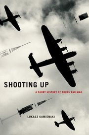
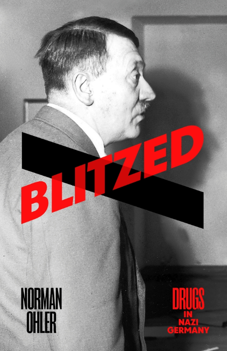
Not the ‘war on drugs’ but the war through drugs: Mike Jay‘s sharp review essay (‘Don’t fight sober’) on Łukasz Kamieński‘s brilliantly titled Shooting Up: a short history of drugs and war and Norman Ohler‘s over-the-top Blitzed: drugs in Nazi Germany (for another, equally critical take on Ohler, see Richard J Evans‘s splenetic review here; more – and more appreciative – from Rachel Cooke‘s interview with Ohler here).

Here’s an extract from Mike’s review:

9780190263478In Shooting Up, a historical survey of drugs in warfare that grew out of his research into future military applications of biotechnology, Łukasz Kamieński lists some of the obstacles to getting the facts straight. State authorities tend to cloak drug use in secrecy, for tactical advantage and because it frequently conflicts with civilian norms and laws. Conversely it can be exaggerated to strike fear into the enemy, or the enemy’s success and morale can be imputed to it. When drugs are illegal, as they often are in modern irregular warfare, trafficking or consumption is routinely denied. The negative consequences of drug use are covered up or explained away as the result of injury or trauma, and longer-term sequels are buried within the complex of post-traumatic disorders. Soldiers aren’t fully informed of the properties and potency of the drugs they’re consuming. Different perceptions of their role circulate even among participants fighting side by side.

Kamieński confines the use of alcohol in war to his prologue and wisely so, or the rest of the book would risk becoming a footnote to it. A historical sweep from the Battle of Hastings to Waterloo or ancient Greece to Vietnam suggests that war has rarely been fought sober. This is unsurprising in view of the many different functions alcohol performs. It has always been an indispensable battlefield medicine and is still pressed into service today as antiseptic, analgesic, anaesthetic and post-trauma stimulant. It has a central role in boosting morale and small-group bonding; it can facilitate the private management of stress and injury; and it makes sleep possible where noise, discomfort or stress would otherwise prevent it. After the fighting is done, it becomes an aid to relaxation and recovery.

All these functions are subsidiary to its combat role and Kamieński’s particular interest, the extent to which drugs can transform soldiers into superhuman fighting machines. ‘Dutch courage’ – originally the genever drunk by British soldiers during the Thirty Years’ War – has many components. With alcohol, soldiers can tolerate higher levels of pain and hardship, conquer fear and perform acts of selfless daring they would never attempt without it. It promotes disinhibition, loosens cultural taboos and makes troops more easily capable of acts that in civilian life would be deemed criminal or insane. The distribution of alcohol and other drugs by medics or superior officers has an important symbolic function, giving soldiers permission to perform such acts and to distance themselves from what they become when they’re intoxicated.

Opium, cannabis and coca all played supporting roles on the premodern battlefield but it was only with the industrialisation of pharmaceutical production that other drugs emerged fully from alcohol’s shadow. Morphine was widely used for the first time in the American Civil War and the 19th-century cocaine boom began with research into its military application. Freud was first alerted to it by the work of the army surgeon Theodor Aschenbrandt, who in 1883 secretly added it to the drinking water of Bavarian recruits and found that it made them better able to endure hunger, strain and fatigue. During the First World War cocaine produced in Java by the neutral Dutch was exported in large quantities to both sides. British forces could get it over the counter in products such as Burroughs Wellcome’s ‘Forced March’ tablets, until alarms about mass addiction among the troops led to a ban on open sales under the Defence of the Realm Act in 1916.

cover-jpg-rendition-460-707During the 1930s a new class of stimulants emerged from the laboratory, cheap to produce, longer-acting and allegedly less addictive. Amphetamine was first brought to market in the US by Smith, Kline and French in 1934 in the form of a bronchial inhaler, Benzedrine, but its stimulant properties were soon recognised and it was made available in tablet form as a remedy for narcolepsy and a tonic against depression. As with cocaine, one of its first applications was as a performance booster in sport. Its use by American athletes during the Munich Olympic Games in 1936 brought it to the attention of the German Reich and by the end of the following year the Temmler pharmaceutical factory in Berlin had synthesised a more powerful variant, methamphetamine, and trademarked it under the name Pervitin. As Norman Ohler relates in Blitzed, research into its military applications began almost immediately; it was used in combat for the first time in the early stages of the Second World War. Ohler’s hyperkinetic, immersive prose evokes its subjective effects on the German Wehrmacht far more vividly than any previous account, but it also blurs the line between myth and reality.

This too blurs the line between myth and reality, or so you might think.  Geoff Manaugh‘s ever-interesting BldgBlog reports that the US Department of Defense ‘is looking to develop “biodegradable training ammunition loaded with specialized seeds to grow environmentally beneficial plants that eliminate ammunition debris and contaminants”.’  Sustainable shooting.  But notice this is ammunition only for use in proving grounds…

shotgun

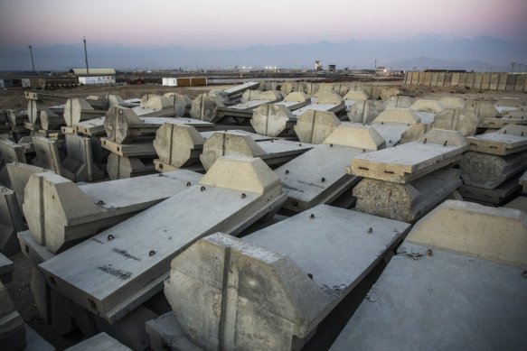
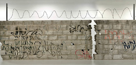
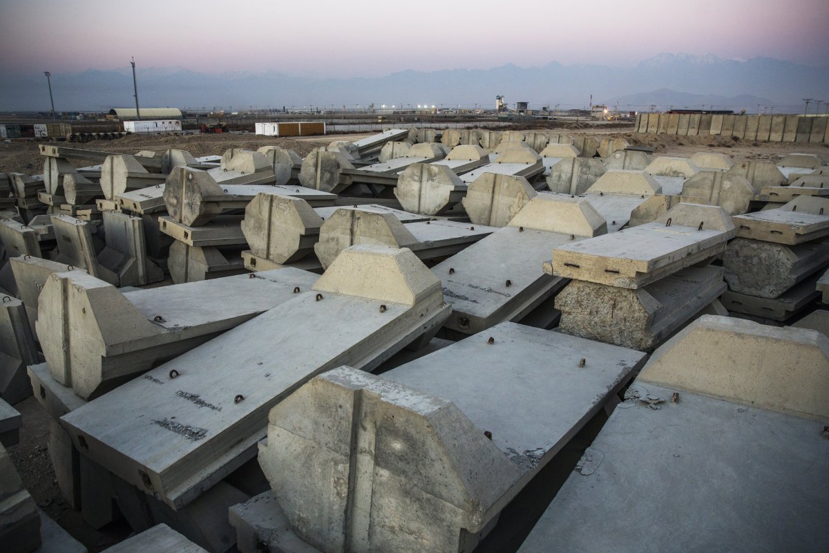
At the other end of the sustainable spectrum, John Spencer suggests that ‘The most effective weapon on the modern battlefield is concrete‘.  To put it simply, you bring today’s liquid wars to a juddering halt – on the ground at any rate – by turning liquidity into solidity and confounding the mobility of the enemy:

Ask any Iraq War veteran about Jersey, Alaska, Texas, and Colorado and you will be surprised to get stories not about states, but about concrete barriers. Many soldiers deployed to Iraq became experts in concrete during their combat tours. Concrete is as symbolic to their deployments as the weapons they carried. No other weapon or technology has done more to contribute to achieving strategic goals of providing security, protecting populations, establishing stability, and eliminating terrorist threats. This was most evident in the complex urban terrain of Baghdad, Iraq. Increasing urbanization and its consequent influence on global patterns of conflict mean that the US military is almost certain to be fighting in cities again in our future wars. Military planners would be derelict in their duty if they allowed the hard-won lessons about concrete learned on Baghdad’s streets to be forgotten.

When I deployed to Iraq as an infantry soldier in 2008 I never imagined I would become a pseudo-expert in concrete, but that is what happened—from small concrete barriers used for traffic control points to giant ones to protect against deadly threats like improvised explosive devices (IEDs) and indirect fire from rockets and mortars. Miniature concrete barriers were given out by senior leaders as gifts to represent entire tours. By the end my deployment, I could tell you how much each concrete barrier weighed. How much each barrier cost. What crane was needed to lift different types. How many could be emplaced in a single night. How many could be moved with a military vehicle before its hydraulics failed.
Baghdad was strewn with concrete—barriers, walls, and guard towers. Each type was named for a state, denoting their relative sizes and weights. There were small barriers like the Jersey (three feet tall; two tons), medium ones like the Colorado (six feet tall; 3.5 tons) and Texas (six feet, eight inches tall; six tons), and large ones like the Alaska (12 feet tall; seven tons). And there were T-walls (12 feet tall; six tons), and actual structures such as bunkers (six feet tall; eight tons) and guard towers (15 to 28 feet tall).

concrete-barriers-stored-at-bagram-afb-january-2015

But it’s nor only a matter of freezing movement:

Concrete also gave soldiers freedom to maneuver in urban environments. In the early years of the war, US forces searched for suitable spaces in which to live. Commanders looked for abandoned factories, government buildings, and in some situations, schools. Existing structures surrounded by walled compounds of some type were selected because there was little in the environment to use for protection—such as dirt to fill sandbags, earthworks, or existing obstacles. As their skills in employing concrete advanced, soldiers could occupy any open ground and within weeks have a large walled compound with hardened guard towers.

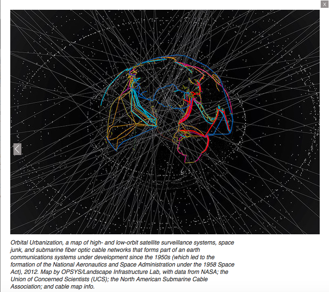
Now up into the air.  My posts on the US Air Force’s Bombing Encyclopedia (here and here) continue to attract lots of traffic; I now realise that the project – a targeting gazetteer for Strategic Air Command – needs to be understood in relation to a considerable number of other texts.  Elliott Child has alerted me to the prisoner/defector interrogations that provided vital intelligence for the identification of targets – more soon, I hope – while those targets also wound their way into the President’s Daily Brief (this was an era when most Presidents read the briefs and took them seriously, though Nixon evidently shared Trump’s disdain for the CIA: see here.)  James David has now prepared a National Security Archive Electronic Briefing Book (No 574) which provides many more details based on redacted releases of Briefs for the period 1961-77.

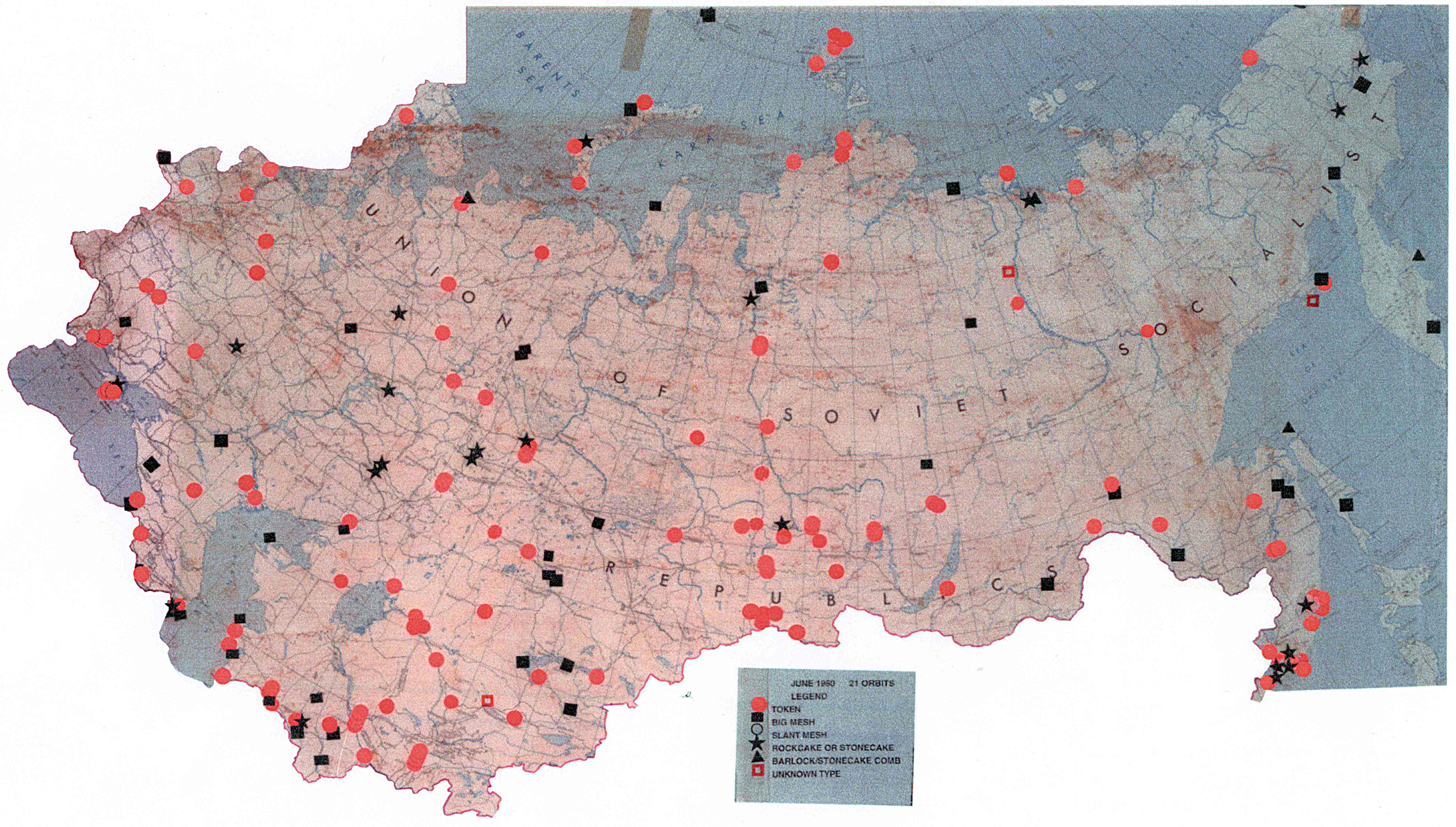
Two of the most critical intelligence targets throughout the Cold War were Soviet missile and space programs. U.S. intelligence agencies devoted a huge amount of resources to acquiring timely and accurate data on them. Photoreconnaissance satellites located launch complexes and provided data on the number and type of launchers, buildings, ground support equipment, and other key features. They located R&D centers, manufacturing plants, shipyards, naval bases, radars, and other facilities and obtained technical details on them. The satellites also occasionally imaged missiles and rockets on launch pads. There were four successful photoreconnaissance satellite programs during the four administrations in question. CORONA, a broad area search system, operated from August 1960 until May 1972. The first successful high resolution system, GAMBIT-1, flew from 1963-1967. The improved GAMBIT-3 high resolution satellite was launched from 1966-1984. HEXAGON, the broad area search successor to CORONA, operated from 1971-1984. High-resolution ground photography of missiles and rockets displayed at Moscow parades and other events also proved valuable at times.

sigint-targets-ussr

Signals intelligence platforms [above] also contributed greatly to understanding Soviet missile and space programs. Satellites such as GRAB (1960-1962), POPPY (1962-1971), and AFTRACK payloads (1960-1967) located and intercepted air defense, anti-ballistic missile, and other radars and added significantly to U.S. knowledge of Soviet defensive systems and to the development of countermeasures. Other still-classified signals intelligence satellites launched beginning around 1970 reportedly intercepted telemetry and other data downlinked from missiles, rockets, and satellites to Soviet ground stations, and commands uplinked from the stations to these vehicles. Antennas at intercept sites also recorded this downlinked data. During the latter stages of missile and rocket tests to the Kamchatka Peninsula and the Pacific, ships and aircraft also intercepted telemetry and acquired optical data of the vehicles. Analysis of the telemetry and other data enabled the intelligence agencies to determine the performance characteristics of missiles, rockets, and satellites and helped establish their specific missions. Radars at ground stations detected launches, helped determine missile trajectories, observed the reentry of vehicles, and assisted in estimating the configuration and dimensions of missiles and satellites. Space Surveillance Network radars and optical sensors detected satellites and established their orbital elements. The optical sensors apparently also photographed satellites.

And for a more recent take on sensors and shooters, coming from Yale in the Spring: Christopher J Fuller‘s See It/Shoot It: The secret history of the CIA’s lethal drone program:

An illuminating study tracing the evolution of drone technology and counterterrorism policy from the Reagan to the Obama administrations.

This eye-opening study uncovers the history of the most important instrument of U.S. counterterrorism today: the armed drone. It reveals that, contrary to popular belief, the CIA’s covert drone program is not a product of 9/11. Rather, it is the result of U.S. counterterrorism practices extending back to an influential group of policy makers in the Reagan administration.

Tracing the evolution of counterterrorism policy and drone technology from the fallout of Iran-Contra and the CIA’s “Eagle Program” prototype in the mid-1980s to the emergence of al-Qaeda, Fuller shows how George W. Bush and Obama built upon or discarded strategies from the Reagan and Clinton eras as they responded to changes in the partisan environment, the perceived level of threat, and technological advances. Examining a range of counterterrorism strategies, he reveals why the CIA’s drones became the United States’ preferred tool for pursuing the decades-old goal of preemptively targeting anti-American terrorists around the world.

You can get a preview of the argument in his ‘The Eagle Comes Home to Roost: The Historical Origins of the CIA’s Lethal Drone Program’ in Intelligence & National Security 30 (6) (2015) 769-92; you can access a version of that essay, with some of his early essays on the US as what he now calls a ‘post-territorial empire’, via Academia here.

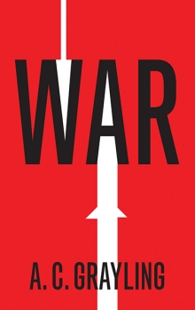
Finally, also forthcoming from Yale, a reflection on War by A.C. Grayling (whose Among the Dead Cities was one of the inspirations for my own work on bombing):

grayling-warFor residents of the twenty-first century, a vision of a future without warfare is almost inconceivable. Though wars are terrible and destructive, they also seem unavoidable. In this original and deeply considered book, A. C. Grayling examines, tests, and challenges the concept of war. He proposes that a deeper, more accurate understanding of war may enable us to reduce its frequency, mitigate its horrors, and lessen the burden of its consequences.

Grayling explores the long, tragic history of war and how warfare has changed in response to technological advances. He probes much-debated theories concerning the causes of war and considers positive changes that may result from war. How might these results be achieved without violence? In a profoundly wise conclusion, the author envisions “just war theory” in new moral terms, taking into account the lessons of World War II and the Holocaust and laying down ethical principles for going to war and for conduct during war.

Palestine under occupation

ss-161228-israel-settlements-jpo-01_d3f9ab894ba27b4673efb72a928d04e0-nbcnews-ux-1024-900

I’ve been struggling with the flu, and even more with Netanyahu’s bilious reaction to the UN Settlements Resolution and John Kerry‘s statement of the obvious about the illegal Israeli colonisation of the West Bank.  (If you want the background, then Eyal Weizman‘s Hollow Land is the place to start, while the Foundation for Middle East Peace is an indispensable resource for tracking the colonisation process up to 2014).

So I was pleased to receive this notice of a research workshop at Queen Mary, University of London on 26 May 2017:

Palestine under occupation: the legitimation of violence and the violence of legitimation

We invite proposals for papers to be presented at this one-day research workshop hosted by the School of Politics and International Relations at Queen Mary, University of London. The workshop will consist of a series of panels during the day followed by a public lecture.

This workshop considers the connection between violence and legitimation in the maintenance of the occupation of Palestine. The Israeli colonisation of Palestine demands an interrogation of the techniques, strategies, and discourses through which this violent state of affairs is legitimated, especially as it takes on more extreme forms such as the recent wars in Gaza. This workshop seeks firstly to bring together existing scholarship which has examined the legitimation of Israeli state violence through practices such as law, human rights, ethics, visual representations, narrative, memory, and history. However, it also seeks to examine these issues alongside other questions surrounding the legitimation and de-legitimation of Palestinian actors, agendas, and political strategies, particularly in the wake of recent high profile attempts to restrict international solidarity activism. The conference asks whether and how these contemporary struggles over legitimacy and violence are related, and what their interrogation might reveal about each other.

The workshop’s departure point is a critical analysis of the order surrounding the legitimation of violence, asking how global ethics, international law, racial hierarchies, gender domination, economic exchange and state-making practices have shaped the permissible use of violence, as well as the possible strategies for resisting this violence. For example, has the statelessness of Palestinian resistance meant a lack of access not only to technological ‘advanced’ forms of warfare, but also the inability to claim the legitimate authority of state-wielded violence? Have orders of acceptable violence led to the reproduction of Israeli state violence? And has the circulation of Israel’s strategies of legitimation abroad also served to strengthen the legitimisation of its use of violence in Palestine?

The workshop also seeks to raise more fundamental questions about the political and analytic categories of legitimation and violence themselves. These questions prompt us to consider not only how practices of legitimation directly facilitate violence, but also how this very interaction modifies existing understandings of legitimacy and illegitimacy, violence and non-violence. At what point do legitimation and de-legitimation, insofar as they structure the field of domination of some actors over others, not only depend on violence but also become violent practices in and of themselves? These concerns echo some of those articulated in Walter Benjamin’s critique of violence and Foucault’s historico-political analysis of war. But they also push the categories of these inquiries further through consideration of the relationship of legitimacy and violence in a colonial setting in which statehood remains a highly contested political field.

Proposals may wish to address one or more of the questions below:

Through what strategies has Israel sought to legitimate the violence of its occupation of Palestine, and how have these been resisted?
What forms has the struggle for political legitimacy in Palestine taken, and what has been the corresponding role of attempts at de-legitimisation?
How are struggles over legitimacy and violence in Palestine related, and how does this affect our understanding of the meaning and instantiation of these concepts?
How have different state-making technologies, apparatuses, norms and institutions ordered permissible forms of violence both historically and contemporarily in Israel and Palestine?
What tools, both conceptual and strategic, are needed to reorder the legitimation of violence which structure the continued occupation of Palestine?

In framing proposals, we encourage contributors to approach the occupation of Palestine in its full historical and geographical dimensions, ranging if necessary beyond the experience of the Occupied Palestinian Territory since 1967 and/or the post-1948 period.

screen-shot-2017-01-03-at-13-19-49
Keynote speaker: Noura Erakat. Noura is a human rights attorney and currently an Assistant Professor at George Mason University; a co-editor of Jadaliyya  – another indispensable resource – she is working on a book-length manuscript that narrates the Palestinian-Israel conflict through critical junctures in international law.

Please submit abstracts of no more than 300 words to James Eastwood (james.eastwood@qmul.ac.uk) and Catherine Charrett (c.charrett@qmul.ac.uk).

Funds are available for modest travel bursaries for research students and early career academics. Please contact the organisers for more details.

Deadline for proposals: 24th February 2017.