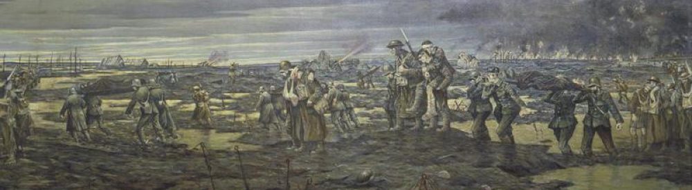
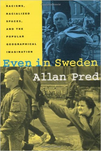
In the wake of the Trump administration’s shock at the non-existent Bowling Green Massacre, its fabricated comments on immigrants, refugees and crime in Sweden (for the record, I’ve been to Rinkeby in the company of Nordic geographers, and I also have Allan Pred‘s brilliant Even in Sweden on my shelves: and I’d also recommend Gavan Titley‘s elegant ‘Swedens of the mind‘ over at Critical Legal Thinking), and – in spectacular contrast – Trump’s sullen silence over attacks on immigrants, refugees and Muslims that did happen, The Bureau of Investigative Journalism has just published an important and incisive take-down of a map that went viral (the mot juste) in 2016.
Its reporters explain:
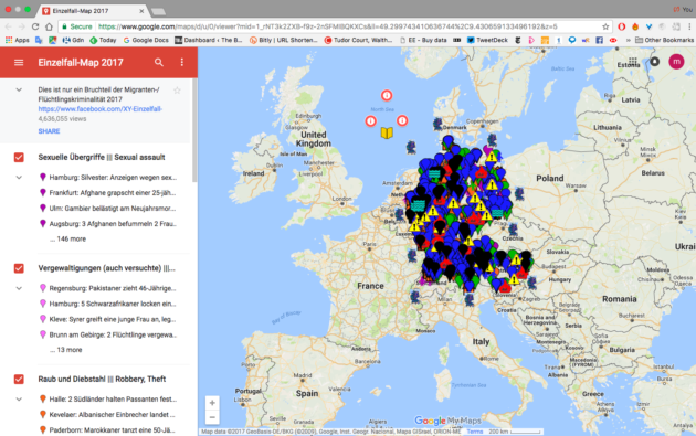
Last year, an anonymously-produced map started to make its way around German social media. It claimed to show viewers the spread of “refugee and migrant crime” throughout Germany.
Unlike some of the lurid tales of migrant depravity that have circulated in Germany in recent months and turned out to be false, the interactive map seemed professionally put together. Each pin on it correlated to a police or media report of a crime (“we don’t document cases simply on the basis of hearsay”, its makers claimed).
The map, called XY-Einzelfall (a sarcastic riposte to the idea each migrant crime is simply an ‘isolated case’ – Einzelfall in German) was viewed more than four million times.

One of the XY-Einzelfall (XYE) social media followers tweeted over 80 times as new crimes were added to the map: “The time’s coming when Germans will need to carry guns for self-protection.”
But analysis of the map’s methodology by the Bureau of Investigative Journalism shows that it is systematically misleading, often attributing crimes to migrants or refugees on the basis of nothing more than a witness statement that the perpetrator was “dark-skinned” or “southern”. On top of this, the project vastly overstates the figures on migrant crime through skewed use of statistics.
Tracing the map’s presence on social media also shows it to be far from politically neutral. An account in XYE’s name on the Russian social media site VKontakte is rife with the kind of pro-Trump pro-Putin memes which have become the signature of the global alt-right. These are also the dominant affiliations of the Twitter accounts promoting the map. Overtly racist and xenophobic memes are also commonplace.
Most readers – especially those familiar with the stream of work set in motion by Brian Harley – will not be surprised to find that the map’s authors summon the supposed objectivity and facticity of cartography as a legitimating device:
The map’s creators like to portray their approach as scientific, mimicking the language of academics and think tanks. In January they released a “7-day analysis of published police reports”, with a breakdown of crimes by groups of different origins and a headline suggesting that 84% of crimes were committed by migrants.
In fact, the 84% figure is completely misleading. The map makers have stripped out all crimes in which the perpetrators’ background is not mentioned from their calculation. The true percentage of crimes in this period committed by migrants – according to XYE’s own data – is 13%. There is a further 13% of crimes which the XYE say are ‘probably’ committed by migrants.
We looked at how XYE decide that each pin on the map represents a crime which could have been committed by migrants. They comb police and media reports and pull out descriptions of perpetrators. We found that almost two-thirds of their reported offenders fell into the categories of “dark-skinned”, “southern-looking”, “foreigner” or “refugee”.
We then selected a random sample of 100 reports within each of these four categories for closer analysis. We found that in nearly all cases where the perpetrator was described as “dark-skinned” or “southern”, there was no evidence in the sources positively identifying them as a migrant or refugee. This was also true of the overwhelming majority of cases where the offender was described as a “foreigner”.
I’m en route to Vancouver, so forgive the brevity of this notice of such an important issue.